Topcon releases MAGNET Relay for GIS
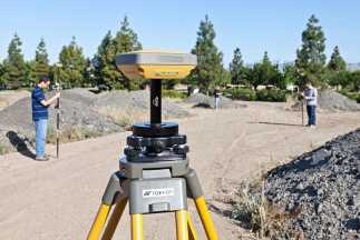
Topcon Positioning Group announces the addition of MAGNET® Relay for GIS to its suite of cloud-based solutions software. As a component of MAGNET Field GIS, MAGNET Relay GIS is a mobile base station RTK (Real Time Kinematic) broadcasting service. The system is designed to allow subscribers to connect a GNSS base receiver to MAGNET Relay via a cellular connection for high-accuracy RTK corrections.
“The RTK base station can be used by up to ten rovers, which makes MAGNET Relay a great solution for large scale and highly precise GIS projects,” said Jason Hooten, Topcon national sales manager for GIS products.
“MAGNET Relay for GIS allows for data to be collected in the field without the need for post processing, and then quickly transferred to the office using the company’s secure, cloud-based MAGNET Enterprise account,” said Hooten. “Additionally, the service brings real-time network-based corrections to project sites that do not have existing coverage.”
For more information on MAGNET system of solutions, visit magnet-tour.com.
More Stories

Topcon to showcase latest technologies for geospatial industry at Intergeo
Learn More
Topcon expands construction layout portfolio with LN-50
Learn More